
.svg)

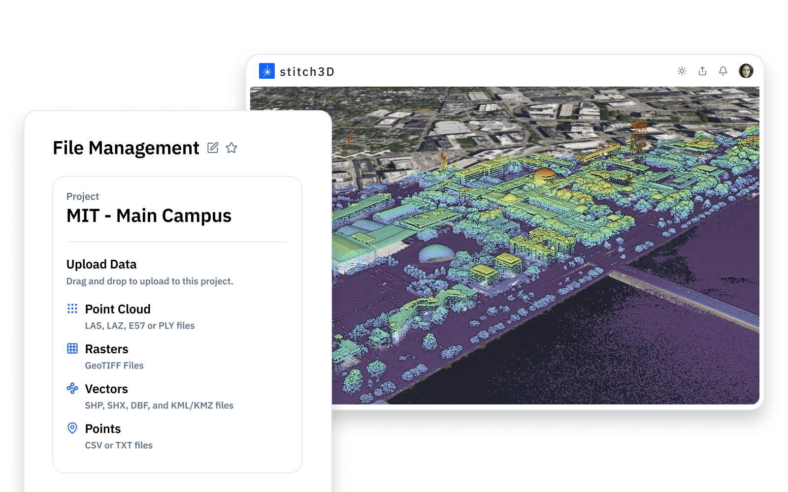
Files

PROJECTS
TEAMS

Compatible with any point cloud and drone data

Point clouds (.LAS/.LAZ, .E57, and .PLY) up to 1TB
Rasters (TIF and DEM) up to 25GB
Vectors (SHP, DXF, KML/KMZ, GPKG)
Media Images (JPG, PNG, WebP)
Points (CSV, TXT)
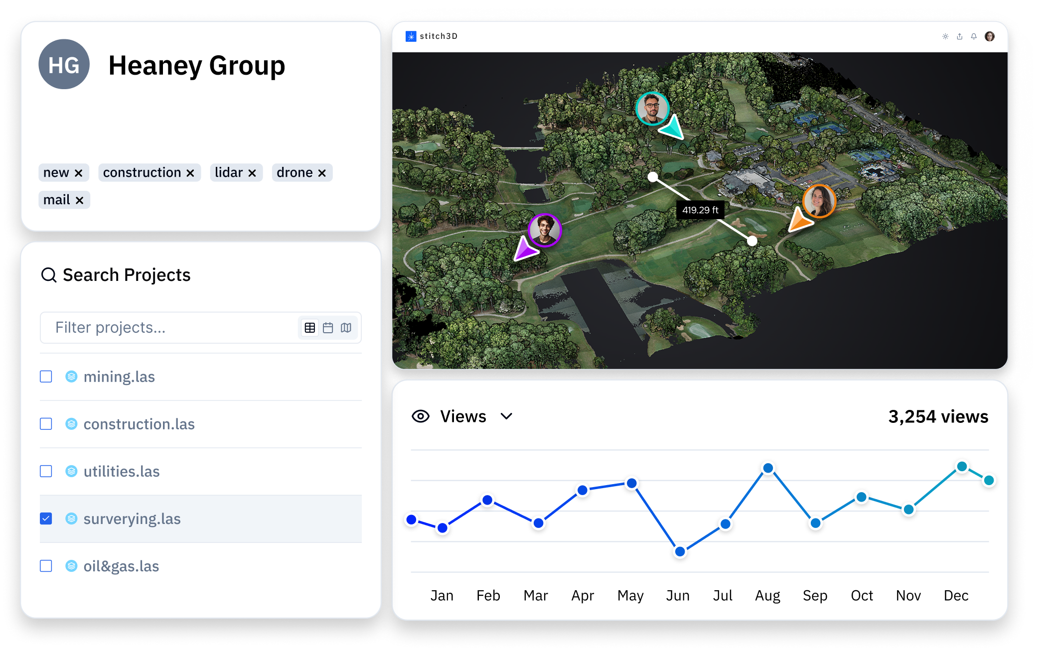
The first (and only) 2D/3D real-time multiplayer viewer
Easily toggle between 2D and 3D visualization
Invite up to 50 people into your scene
Supports all point cloud attributes with custom navigation and metadata exposure
Intuitive yet powerful tools to understand your data
Drop point, distance, and area measurements for shared client access
Measure cut/fill volume, weight, and price by selecting from a list of predefined materials or create your own
Create and export height profiles or slice through your model for doll house and top-down views
Turn on satellite or street maps for added context
Project your data to the defined coordinate reference system
Layer 2D and 3D data to geospatially accurate basemaps
Quickly identify latitude/longitude and X/Y/Z location information
One viewer, multiple files. Align your deliverables for unified viewing
See all your point clouds, orthos, and vectors or view them one at a time
Control each layer separately with custom transparency and attributes
Upload/Download one file or all layers together
See how your team and clients are interacting with the data
Track file metrics such as public downloads, visits, and reshares
Control user access and roles with multitenancy and customer management tools
White label your viewer and customize your public links for SEO
Case Study 01
READ MORE
Traditional airfield obstacle surveys are slow and inconsistent, leaving critical airspace vulnerable to obstructions from vegetation growth.
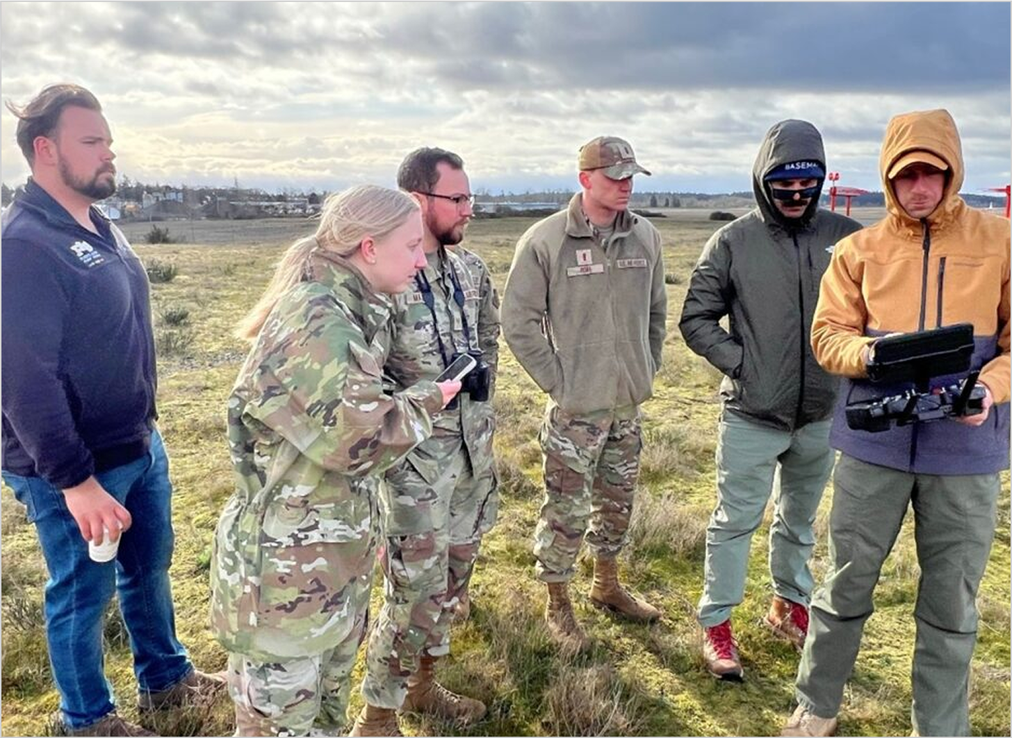
Using drone-based LiDAR and Stitch3D’s cloud platform, U.S. Air Force and Army engineers at JBLM captured high-density 3D point clouds of forests surrounding McChord Airfield, enabling faster and more routine obstacle detection.
Within a 48 hour mission window, hundreds of trees were identified and marked as obstructions, setting a new standard for airfield surveys and enhancing safety protocols.
Case Study 02
WATCH VIDEO
In the aftermath of the Lahaina wildfire, planners and contractors urgently needed updated terrain and structural data—but with only three licensed land surveyors on Maui, traditional methods couldn't keep pace with recovery demands.
Drone service providers partnered with local land surveyors to capture high-resolution LiDAR and terrain data, using Stitch3D to securely share 3D visuals and analytics with government and commercial stakeholders in real time.
LiDAR data is now captured regularly and delivered instantly via Stitch3D’s collaborative 3D web viewer—providing trusted, tactical access when and where it’s needed most.

SIGN UP FREE
© 2025 Stitch3D. All rights reserved.